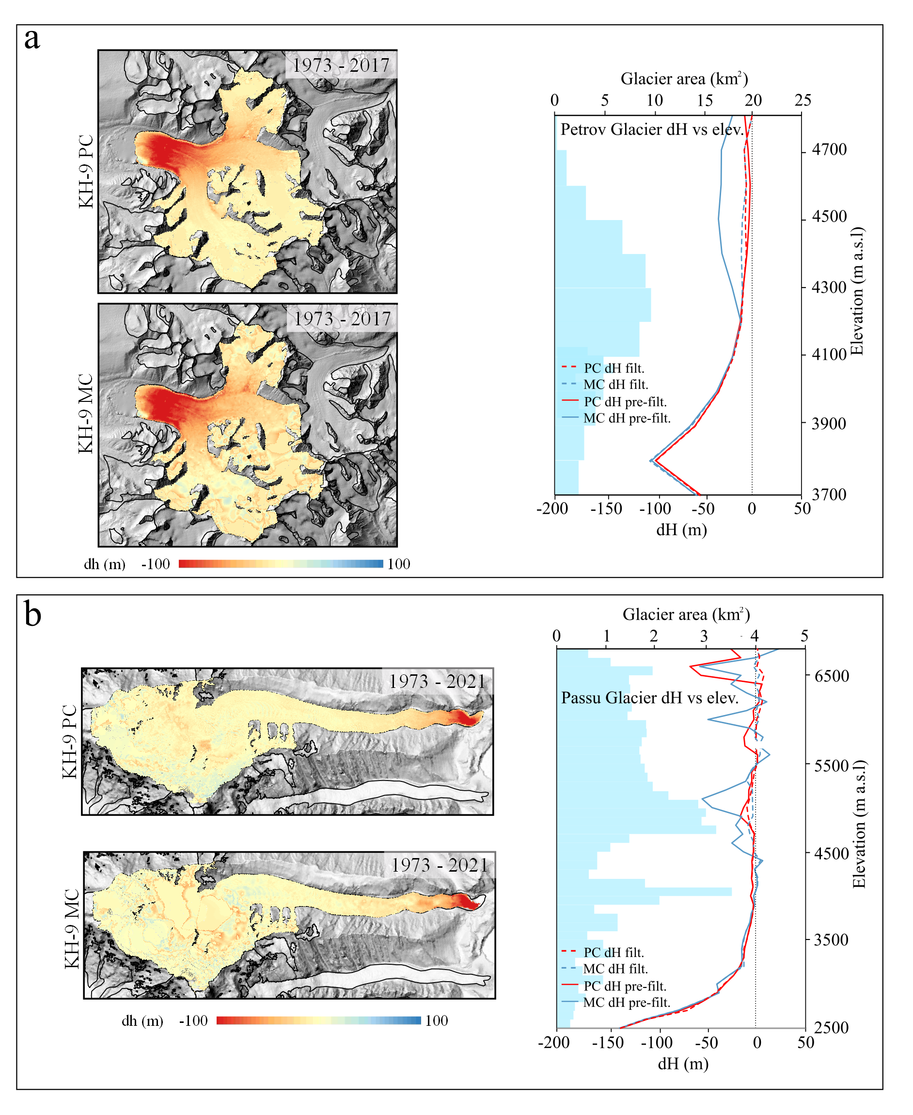
The panoramic cameras (PCs) on board Hexagon KH-9 (KH-9PC) satellite missions from 1971–1984 captured very high-resolution stereo imagery with up to 60 cm spatial resolution. This study explores the potential of this imagery for glacier mapping and change estimation. We assess KH-9PC imagery using data from the KH-9 mapping camera (KH-9MC), KH-4PC, and SPOT and Pléiades satellite imagery. The high resolution of KH-9PC leads to higher-quality DEMs, which better resolve the accumulation region of the glaciers in comparison to the KH-9MC. On stable terrain, KH-9PC DEMs achieve an elevation accuracy of <4 m with respect to SPOT and Pléiades DEMs. While the estimated geodetic mass balances using PC and MC data are similar after outlier filtering, the elevation change data show superior spatial coverage and considerably less noise when using KH-9PC data.
New article: Glacier mapping and change estimation using very high-resolution declassified Hexagon KH-9 panoramic stereo imagery (1971–1984)
You Might Also Like

Tobias Bolch amongst the world’s most influential researchers in 2023…again!
New article: Past, present, and future geo-biosphere interactions on the Tibetan Plateau and implications for permafrost