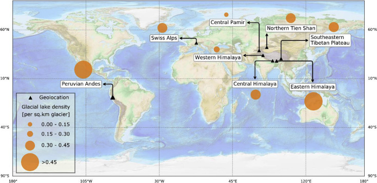
The water body detection and mapping algorithm named 'glakemap' was aimed at specifically mapping glacial lakes across alpine regions where their detection and mapping are challenged by many factors such as shadows, cloud cover, turbidity, and ice surface.
The algorithm uses Copernicus Sentinel-1 and -2 satellites data and machine learning model (random forest) in an integrated manner to automatically classify glacial lakes from other surface features. In specific, the algorithm takes Sentinel-1 and -2 satellites data as the main inputs. It calculates radar backscatter and Normalised Difference Water Indices (NDWIs) using these datasets, respectively. The radar backscatter and NDWIs products (images) are segmented using a set of rules producing many polygons including lake polygons. Lake polygons are then automatically separated/retained using the random forest model which is trained using features relevant to lakes.
References
Wangchuk, S. and Bolch, T.: Mapping of glacial lakes using Sentinel-1 and Sentinel-2 data and a random forest classifier: Strengths and challenges, Sci. Remote Sens., 2, 100008, https://doi.org/10.1016/j.srs.2020.100008, 2020.
When using this dataset, please cite the above reference (Wangchuk & Bolch 2020).

